Saturday, January 13, 2007

Amsterdam: Where to stay, what to do


Slideshow: Faces of Amsterdam


Where to Stay

Where to Eat

What to Do

When to Go

High season is the spring tulip season (early Apr to mid-May) and the school vacations in July and August. The city is very busy at both times, which means that hotel rooms are hard to find and bargains don't exist at all (but who wants to tiptoe through the tulips in November, or sit on a sidewalk cafe terrace in a snowstorm?).

If you're planning to travel at these times, you should book several months in advance. Summer is also the best time for cycling, which is an essential Dutch experience; try a canal bike if you're squeamish about going on the roads.

In winter, room rates are generally cheaper, and cafes and restaurants are less crowded and more genuine in feel. You won't find such a big line to get into the Anne Frankhuis (though you'll still find a line); you'll be able to stand longer in front of Rembrandt's The Night Watch and your favorite Van Gogh; and you might get a chance to go skating on the canals.

You also get a better view of those canals, because the trees that border them shed their screen of leaves in the winter; and as an added bonus, the lights from all those canal-side windows, whose curtains are never closed, glow with Japanese-lantern charm on the inky surface.

There's no worst of times to visit Amsterdam: It's a year-round stimulation of the brain's pleasure center.

Friday, January 12, 2007

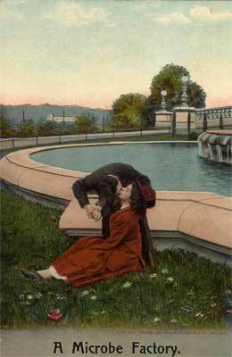
Funny honeymoon postcards


The golden age of postcards ran from 1898 to 1918, when millions of beautifully drawn postcards passed through the mail.

On this page and the following links, you can view funny postcards from this era and beyond, all poking gentle fun at honeymoon couples.

Funny Honeymoon Gay Old Time

Funny Honeymoon Nosy Neighbors

Funny Honeymoon Spooning

Funny Honeymoon Robbery

Funny Honeymoon - It's a Snore!

What goes in your honeymooon scrapbook?

Once your honeymoon or romantic vacation is over, how will you remember it?
If you'd rather not trust your experiences to memory, consider creating a vacation scrapbook where you preserve images and ephemera you gather on your travels.

What goes in your honeymooon scrapbook?


  • postcards from everywhere you visit
  • prints of your best digital photos
  • restaurant menus
  • hotel stationery
  • wine/champagne labels
  • paper luggage tags
  • journal/diary/sketchbook pages
  • hand-written copy of a favorite poem
  • noteworthy charge card receipts
  • stickers and decals
  • drink coasters/umbrellas
  • invitations
  • maps and tourbook pages
  • itinerary
  • pretty wrappers
  • plastic room keys
  • business cards
  • handmade papers
  • matchbooks
  • small pins
  • souvenir magnets
  • airline/train/admission ticket stubs
  • swatches of material
  • ribbon and wrapping paper
  • colorful stamps and currency
  • dried flowers

Use your imagination to come up with even more travel treasures to personalize your scrapbook -- and have a great time collecting them!

Thursday, January 11, 2007

Video: Follow the birds to the Taj Mahal

Follow the birds flying in the sky.
They will lead you to the Taj Mahal.
Nature is always right.


votefortaj.com

World's smallest country up for sale

For sale: the world's smallest country with its own flag, stamps, currency and passports.

Apply to Prince Michael of Sealand if you want to
run your own storm-tossed nation - even if it is just a wartime fort perched on two concrete towers in the North Sea.

The owners of the world's "smallest state" - Sealand - have put the quasi-country up for sale, reports the BBC.

The former anti-aircraft platform, seven miles off the Essex coast, was taken over 40 years ago by retired Army major Paddy Roy Bates.

The so-called "independent state" of Sealand is currently home to an internet firm.

It was derelict until the 1960s when Mr Bates took over the 10,000 sq ft platform and declared it the independent nation of Sealand.

At the time, the platform was beyond the then three-mile limit of British territorial waters. All this changed in 1987, when the UK extended its territorial waters from three to 12 miles.

Sealand's current "head of state", Mr Bates' son Michael, said he was only 14 when they took over the platform, but now seemed the right time to sell up.

"Michael of Sealand" said the family were approached by a Spanish estate agents specializing in selling islands.

The firm, Inmonaranja, has put a price tag of 750m euros (£504m) on Sealand.

Wednesday, January 10, 2007

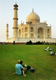
The Taj Mahal in danger of being eliminated


India’s pride and joy, The Taj Mahal, is lagging behind at number 22 in the race to be nominated as one of the New 7 Wonders of the World.

Do your bit to prevent the The Taj Mahal from being eliminated .


Go to votefortaj.com, vote and help spread the word.

In addition to the Taj Mahal, Stonehenge, the Acropolis, the Great Wall and the Pyramids, the candidates are the Statue of Liberty; Eiffel Tower; Peru's Machu Picchu; Turkey's Haghia Sophia; the Kremlin and St. Basil's Cathedral; the Colosseum; Germany's Neuschwanstein Castle; Spain's Alhambra; Japan's Kiyomizu Temple; the Sydney Opera House; Cambodia's Angkor; Timbuktu; Petra, Jordan; Brazil's Statue of Christ Redeemer; Easter Island; and Chichen Itza, Mexico.


As you can see India has some pretty heavyweight competition.

Ancestors online


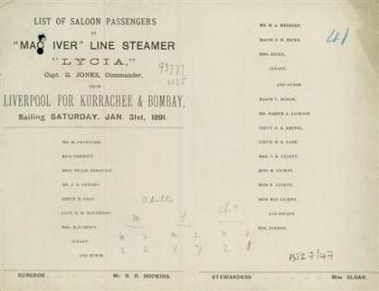
People looking to track ancestors who emigrated from British ports will from Wednesday be able to search online passenger lists of the ships that carried them to new lands.

Released by Britain's National Archives, the passenger manifests give an insight into all long-distance trips made by 30 million travelers from the country's ports between 1890 and 1960, including that of the Titanic which sank in 1912.

The records, available via commercial Web findmypast.com which was licensed by The National Archives, also show the passages of trans-European migrants.

During this period, thousands of Britons were propelled by economic reasons to seek new beginnings abroad. Between 1890 and 1914 an estimated 125,000 Britons emigrated every year to the United States, with 50,000 going to Canada and 25,000 to Australia.

Trips to all continents are covered with sailings to South America, the Caribbean, West Africa and all parts of Asia.

Tuesday, January 09, 2007

30 busiest airports in the world

The thirty world's busiest airports by passenger traffic are measured by number of total passengers in 2006 (data provided by Airports Council International).

1. O'Hare International Airport

Chicago, Illinois, United States

2. Hartsfield-Jackson Atlanta International Airport

Atlanta, Georgia, United States

3. London Heathrow Airport

Hayes, London, United Kingdom

4. Tokyo International Airport (Haneda)

Ota, Tokyo, Japan

5. Los Angeles International Airport

Los Angeles, California, United States

6. Dallas-Fort Worth International Airport

Dallas/Fort Worth, Texas, United States

7. Charles De Gaulle International Airport

Roissy, Tremblay-en-France, Paris, France

8. Frankfurt International Airport

Frankfurt, Hessen, Germany

9. Denver International Airport

Denver, Colorado, United States

10. McCarran International Airport

Las Vegas, Nevada, United States

11. Don Mueang International Airport (Old Bangkok Int'l)

Don Mueang, Bangkok, Thailand

12. Beijing Capital International Airport

Chaoyang, Beijing, People's Republic of China

13. Hong Kong International Airport

Chek Lap Kok, New Territories, Hong Kong, Hong Kong, SAR

14. Sky Harbor International Airport

Phoenix, Arizona, United States

15. George Bush (Houston) Intercontinental Airport

Houston, Texas, United States

16. Barajas International Airport

Madrid, Spain

17. Amsterdam Schiphol Airport

Haarlemmermeer, North Holland, The Netherlands

18. John F. Kennedy International Airport

New York City, New York, United States

19. Orlando McCoy International Airport

Orlando, Florida, United States

20. Detroit Metropolitan Wayne County Airport

Detroit, Michigan, United States

21. Minneapolis-Saint Paul International Airport

Minneapolis/Saint Paul, Minnesota, United States

22. Newark Liberty International Airport

Newark, New Jersey, United States

23. Miami International Airport

Miami, Florida, United States

24. Singapore Changi Airport

Changi, East Region, Singapore

25. San Francisco International Airport

San Francisco, California, United States

26. Narita International Airport

Narita, Chiba, Japan

27. Philadelphia International Airport

Philadelphia, Pennsylvania, United States

28. Kingsford Smith International Airport

Sydney, New South Wales, Australia

29.Toronto Pearson International Airport

Toronto, Ontario, Canada

30. Soekarno-Hatta International Airport (Jakarta)

Jakarta, Indonesia


At the rate tourism and the economy are growing in India, we hope to see Mumbai, New Delhi, Kolkata, Chennai, Bangalore and Hyderabad on this list soon.

Kochi is no backwater


THE best seller “1,000 Places to See Before You Die” includes as one of its don't-miss destinations the “staggeringly beautiful” backwaters of India's Kerala state. The book also says a stopover in Kochi, the gateway to these interconnected lakes, lagoons and canals, is a must. But a quick visit is hardly enough.

Known as the Queen of the Arabian Sea, Kochi has a multilayered colonial history, relaxing ayurvedic spas, colorful Kathakali dance troupes, stately rajah palaces and a laid-back way of life that is a welcome change from India's typical frenzy. As I learned when my husband, Don, and I visited in late October, the people are friendly (“American? Can I take your photo?”), and the children go to school instead of begging on the street (Kerala has a literacy rate of 90 percent; the Indian average is 65 percent).

Kochi was a backpackers' retreat even when it was called Cochin, the colonial name that was officially dropped 10 years ago (locals and visitors still use both names). But amid a blooming of new boutique hotels — two opened on the waterfront in the last year — Kochi is growing up fast.

“The number of international tourists is increasing every year,” said Dhania Us, the manager of the Malabar House, where we stayed. “Their high-spending habits mean other businesses are growing fast, too, like fashion boutiques and antiques shops.”

Chinese, Arabs, Portuguese, Dutch and British have serially dominated this port on the Malabar Coast, exporting tea and spices, and importing their own architecture, religion and cuisine. These influences are still represented, particularly in Fort Cochin, the historic district — from Chinese fishing nets (watch as hapless tourists try to work the giant wooden pulleys) to Dutch houses, Portuguese churches and English trading company buildings. And in nearby Mattancheri, there is a Jewish presence that locals date back to A.D. 72, just after the destruction of the Second Temple of Jerusalem.

Read more.

Monday, January 08, 2007

Were Mars microbes killed by NASA?

NASA space probes that visited Mars 30 years ago may have stumbled upon alien microbes on the Red Planet and inadvertently killed them, a scientist theorizes in a paper released Sunday.

The problem was the Viking space probes of 1976-77 were looking for the wrong kind of life and didn't recognize it, the researcher said in a paper presented at a meeting of the American Astronomical Society in Seattle.

This new report, based on a more expansive view of where life can take root, may have NASA looking for a different type of Martian life form when its next Mars spacecraft is launched later this year, one of the space agency's top scientists told The Associated Press.

Last month, scientists excitedly reported that new photographs of Mars showed geologic changes that suggest water occasionally flows there — the most tantalizing sign that Mars is hospitable to life.

In the '70s, the Viking mission found no signs of life. But it was looking for Earth-like life, in which salt water is the internal liquid of living cells. Given the cold dry conditions of Mars, that life could have evolved on Mars with the key internal fluid consisting of a mix of water and hydrogen peroxide, said Dirk Schulze-Makuch, author of the new research.

Who knows if they are not not revealing themselves because they're scared of us Earthlings now?


51 incredible Earth facts


We live on a sphere of extremes and oddities. In fact it's not really a sphere, but it is a wild planet, mottled with deadly volcanoes, rattled by killer earthquakes, drenched in disastrous deluges. But do you know which were the worst?

Can rocks grow? Where are the planet's hottest, coldest, driest and windiest places? What would you weigh on Mars?

The following list of Earth's extremes and other incredible facts is presented in Q&A format, so you can cover the answers to test your knowledge of the home planet.

1. What is the hottest place on Earth?

Count one wrong if you guessed Death Valley in California. True enough on many days. But El Azizia in Libya recorded a temperature of 136 degrees Fahrenheit ( 57.8 Celsius) on Sept. 13, 1922 -- the hottest ever measured. In Death Valley , it got up to 134 Fahrenheit on July 10, 1913.

2. And the coldest place around here?

Far and away, the coldest temperature ever measured on Earth was -129 Fahrenheit (-89 Celsius) at Vostok, Antarctica , on July 21, 1983 .

3. What makes thunder?

If you thought, "Lightning!" then hats off to you. But I had a more illuminating answer in mind. The air around a lightning bolt is superheated to about five times the temperature of the Sun. This sudden heating causes the air to expand faster than the speed of sound, which compresses the air and forms a shock wave; we hear it as thunder.

4. Can rocks float?

In a volcanic eruption, the violent separation of gas from lava produces a "frothy" rock called pumice, lo aded with gas bubbles. Some of it can float, geologists say. I've never seen this happen, and I'm thankful for that.

5. Can rocks grow?

Yes, but observing the process is less interesting than watching paint dry. Rocks called iron-manganese crusts grow on mountains under the sea. The crusts precipitate material slowly from seawater, growing about 1 millimeter every million years. Your fingernails grow about the same amount every two weeks.

6. How much space dust falls to Earth each year?

Estimates vary, but the USGS says at least 1,000 million grams, or roughly 1,000 tons of material enters the atmosphere every year and makes its way to Earths surface. One group of scientists claims microbes rain down from space, too, and that extraterrestrial organisms are responsible for flu epidemics . There's been no proof of this, and I'm not holding my breath.

7. How far does regular dust blow in the wind?

A 1999 study showed that African dust finds its way to Florida and can help push parts of the state over the prescribed air quality limit for particulate matter set by the U.S. Environmental Protection Agency. The dust is kicked up by high winds in North Africa and carried as high as 20,000 feet (6,100 meters), where it's caught up in the trade winds and carried across the sea. Dust from China makes its way to North America , too.

8. Where is the world’s highest waterfall?

The water of Angel Falls in Venezuela drops 3,212 feet (979 meters).

9. What two great American cities are destined to merge?

The San Andreas fault, which runs north-south, is slipping at a rate of about 2 inches (5 centimeters) per year, causing Los Angeles to move towards San Francisco . Scientists forecast LA will be a suburb of the City by the Bay in about 15 million years.

10. Is Earth a sphere?

Because the planet rotates and is more flexible than you might imagine, it bulges at the midsection, creating a sort of pumpkin shape. The bulge was lessening for centuries but now, suddenly, it is growing, a recent study showed. Accelerated melting of Earth's glaciers is taking the blame for the gain in equatorial girth.

11. What would a 100-pound person weigh on Mars?

The gravity on Mars is 38 percent of that found on Earth at sea level. So a 100-pound person on Earth would weigh 38 pounds on Mars. Based on NASA's present plans, it'll be decades before this assumption can be observationally proved, however.

12. How long is a Martian year?

It's a year long, if you're from Mars. To an earthling, it's nearly twice as long. The red planet takes 687 Earth-days to go around the Sun -- compared to 365 days for Earth. Taking into account Mars' different rotational time (see #13 below) calendars on Mars would be about 670 days long with some leap days needed to keep things square. If you find one, please mail it to me. I'm curious how they worked out the months, given they have two moons. [The initial publication of this fact mistakenly said a Mars calendar would have 687 days.]

13. How long is the average Martian day?

A Martian can sleep (or work) and extra half-hour every day compared to you. Mars days are 24 hours and 37 minutes long, compared to 23 hours, 56 minutes on Earth. A day on any planet in our solar system is determined by how long it takes the world to spin once on its axis, making the Sun appear to rise in the morning and sending it down in the evening.

14. What is the largest volcano?

The Mauna Loa volcano in Hawaii holds the title here on Earth. It rises more than 50,000 feet (9.5 miles or 15.2 kilometers) above its base, which sits under the surface of the sea. But that's all volcanic chump change. Olympus Mons on Mars rises 16 miles (26 kilometers) into the Martian sky. Its base would almost cover the entire state of Arizona .

15. What was the deadliest known earthquake?

The world’s deadliest recorded earthquake occurred in 1557 in central China. It struck a region where most people lived in caves carved from soft rock. The dwellings collapsed, killing an estimated 830,000 people. In 1976 another deadly temblor struck Tangshan, China . More than 250,000 people were killed.

16. What was the strongest earthquake in recent times?

A 1960 Chilean earthquake, which occurred off the coast, had a magnitude of 9.6 and broke a fault more than 1,000 miles (1,600 kilometers) long. An earthquake like that under a ma jor city would challenge the best construction techniques.

17. Which earthquake was more catastrophic: Kobe, Japan or Northridge, California ?

The 1994 Northridge earthquake had a magnitude of 6.7 was responsible for approximately 60 deaths, 9,000 injuries, and more than $40 billion in damage. The Kobe earthquake of 1995 was magnitude 6.8 and killed 5,530 people. There were some 37,000 injuries and more than $100 billion in economic loss.

18. How far is it to the center of the Earth?

The distance from the surface of Earth to the center is about 3,963 miles (6,378 kilometers). Much of Earth is fluid. The mostly solid skin of the planet is only 41 miles (66 kilometers) thick -- thinner than the skin of an apple, relatively speaking.

19. What is the highest mountain?

Climbers who brave Mt. Everest in the Nepal-Tibet section of the Himalayas reach 29,035 feet (nearly 9 kilometers) above sea level . Its height was revised upward by 7 feet based on measurements made in 1999 using the satellite-based Global Positioning System.

20. Has the Moon always been so close?

It used to be much closer! A billion years ago, the Moon was in a tighter orbit, taking just 20 days to go around us and make a month. A day on Earth back then was only 18 hours long. The Moon is still moving away -- about 1.6 inches (4 centimeters) a year. Meanwhile, Earth's rotation is slowing down, lengthening our days. In the distant future, a day will be 960 hours long!

21. Where is the lowest dry point on Earth?

The shore of the Dead Sea in the Middle East is about 1,300 feet (400 meters) below, California , at a mere 282 feet below sea level.

22. Good thing California isn't sinking further, right?

Actually parts of it are, which is so interesting that I snuck this non-question onto the list. In a problem repeated elsewhere in the country, the pumping of natural underground water reservoirs in California is causing the ground to sink up to 4 inches (11 centimeters) per year in places. Water and sewage systems may soon be threatened.

23. What is the longest river?

The Nile River in Africa is 4,160 miles (6,695 kilometers) long.

24. What is the most earthquake-prone state in the United States ?

A laska experiences a magnitude 7 earthquake almost every year, and a magnitude 8 or greater earthquake on average every 14 years. Florida and North Dakota get the fewest earthquakes in the states, even fewer than New York .

25. What's the driest place on Earth?

A place called Arica, in Chile , gets just 0.03 inches (0.76 millimeters) of rain per year. At that rate, it would take a century to fill a coffee cup.

26. What causes a landslide?

Intense rainfall over a short period of time can trigger shallow, fast-moving mud and debris flows. Slow, steady rainfall over a long period of time may trigger deeper, slow-moving landslides. Different mater ials behave differently, too. Every year as much as $2 billion in landslide damage occurs in the United States . In a record-breaking storm in the San Francisco area in January 1982, some 18,000 debris flows were triggered during a single night! Property damage was over $66 million, and 25 people died.

27. How fast can mud flow?

Debris flows are like mud avalanches that can move at speeds in excess of 100 mph (160 kph).

28. Do things inside Earth flow?

You bet. In fact, scientists found in 1999 that molten material in and around Earth's core moves in vortices, swirling pockets whose dynamics are similar to tornadoes and hurricanes. And as you'll learn later in this list, the planet's core moves in other strange ways, too.

29. What is the wettest place on Earth?

Lloro, Colombia averages 523.6 inches of rainfall a year, or more than 40 feet (13 meters). That's about 10 times more than fairly wet major cities in Europe or the United States.

30. Does Earth go through phases, like the Moon?

From Mars, Earth would be seen to go through distinct phases (just as we see Venus change phases). Earth is inside the orbit of Mars, and as the two planets travel around the Sun, sunlight would strike our home planet from different angles during the year. Earth phases can be seen in recent photographs taken by Mars Global Surveyor and the European Mars Express

31. What is the largest canyon?

The Grand Canyon is billed as the world's largest canyon system. Its main branch is 277 miles (446 kilometers) long. But let's compare. Valles Marineris on Mars extends for about 3,000 miles (4,800 kilometers). If added it to a U.S. map, it would stretch from New York City to Los Angeles . In places this vast scar on the Martian surface is 5 miles (8 kilometers) deep.

32. What is the deepest canyon in the United States ?

Over the eons, the Snake River dug Hells Canyon along the Oregon-Idaho border. It is more than 8,000 feet (2.4 kilometers) deep. In contrast, the Grand Canyon is less than 6,000 feet deep -- a bit more than a mile.

33. Is Earth the largest rocky planet in the solar system?

Just barely! Earth's diameter at the equator is 7,926 miles (12,756 kilometers). Venus is 7,521 miles (12,104 kilometers) wide. Mercury and Mars, the other two inner rocky planets, are much smaller. Pluto is rocky, too, but it's comparatively tiny.

34. How many of Earths volcanoes are known to have erupted in historic time?

About 540 volcanoes on land are known. No one knows how many undersea volcanoes have erupted through history.

35. Is air mostly oxygen?

Earth's atmosphere is actually about 80 percent nitrogen. Most of the rest is oxygen, with tiny amounts of other stuff thrown in.

36. What is the highest waterfall in the United States ?

Yosemite Falls in California is 2,425 feet (739 meters).

37. What percentage of the worlds water is in the oceans?

About 97 percent. Oceans make up about two-thirds of Earth's surface, which means that when the next asteroid hits the planet, odds are good it will splash down.

38. Which two landmasses contain the vast majority of the Earths fresh water supply?

Nearly 70 percent of the Earth's fresh-water supply is locked up in the icecaps of Antarctica and Greenland. The remaining fresh-water supply exists in the atmosphere, streams, lakes, or groundwater and accounts for a mere 1 percent of th e Earth's total.

39. Which of the Earths oceans is the largest?

The Pacific Ocean covers 64 million square miles (165 million square kilometers). It is more than two times the size of the Atlantic . It has an average depth of 2.4 miles (3.9 kilometers).

40. Why is Earth mostly crater-free compared to the pockmarked Moon?

Earth is more active, in terms of both geology and weather. Much of our planet's geologic history was long ago folded back inside. Some of that is regurgitated by volcanoes, but the results are pretty hard to study. Even more recent events evident on the surface -- craters that can by millions of years old -- get overgrown by vegetation, weathered by wind and rain, and modified by earthquakes and landslides. The Moon, meanwhile, is geologically quiet and has almost no weather; its craters tell a billions-year- long tale of catastrophic collisions. Interestingly, some o f the oldest Earth rocks might be awaiting discovery on the Moon, having been blasted there billions of years ago by the very asteroid impacts that rattle both worlds.

41. How much surface area does Earth contain?

There are 196,950,711 square miles (510,100,000 square kilometers).

42. What is the largest lake in the world?

By size and volume it is the Caspian Sea , located between southeast Europe and west Asia.

43. Where do most earthquakes and volcanic eruptions occur on Earth?

The majority occur along boundaries of the dozen or so major plates that more or less float on the surface of Earth. One of the most active plate boundaries where earthquakes and eruptions are frequent, for exa mple, is around the massive Pacific Plate commonly referred to as the Pacific Ring of Fire. It fuels shaking and baking from Japan to Alaska to South America .

44. How hot are the planet's innards?

The temperature of Earth increases about 36 degrees Fahrenheit (20 degrees Celsius) for every kilometer (about 0.62 miles) you go down. Near the center, its thought to be at least 7,000 degrees Fahrenheit (3,870 Celsius).

45. What three countries have the greatest number of historically active volcanoes?

The top three countries are Indonesia , Japan , and the United States in descending order of activity.

46. How many people worldwide are at risk from volcanoes?

As of the year 2000, USGS scientists estimated that volcanoes posed a tangible risk to at least 500 million people. This is comparable to the entire population of the world at the beginning of the seventeenth century!

47. Which of the following sources stores the greatest volume of fresh water worldwide: lakes, streams or ground water?

Groundwater comprises a 30 times greater volume than all freshwater lakes, and more than 3,000 times what's in the worlds streams and rivers at any given time. Groundwater is housed in natural underground aquifers, in which the water typically runs around and through the stone and other material.

48. Which earthquake was larger, the 1906 San Francisco earthquake or the 1964 Anchorage, Alaska, temblor?

The Anchorage earthquake had a magnitude of 9.2 , whereas the San Francisco earthquake was a magnitude 7.8. This difference in magnitude equates to 125 times more energy being released in the 1964 quake and accounts for why the Anchorage earthquake was felt over an area of almost 500,000 square miles (1,295,000 square kilometers).

49. Which earthquake was more destructive in terms of loss of life and relative damage costs, the 1906 San Francisco earthquake or the 1964 Anchorage earthquake?

The 1906 San Francisco earthquake tops this category. It was responsible for 700 deaths versus 114 from the Anchorage earthquake. Property damage in San Francisco was also greater in relative terms due to the destructive fires that destroyed mostly wooden structures of the time.

50. Is Earth's core solid?

The inner portion of the core is thought to be solid. But the outer portion of the core appears molten. We've never been there though, so scientists aren't sure of the exact composition. A radical Hollywood-like idea was recently put forth to blow a crack in the planet and send a probe down there to learn more. An interesting bit of recent evidence shows Mars' core may be similarly squishy. Scientists figured this out by studying tides on Mars.

51. Does all of Earth spin at the same rate?

The solid inner core -- a mass of iron comparable to the size of the Moon -- spins faster than the outer portion of the iron core, which is liquid. A study in 1996 showed that over the previous century, the extra speed caused the inner core to gain a quarter-turn on the planet as a whole. So the inner core makes a complete revolution with respect to the rest of Earth in about 400 years. Immense pressure keeps it solid.


(via email.)


Saturday, January 06, 2007

Ganges River pollution threatens pilgrims


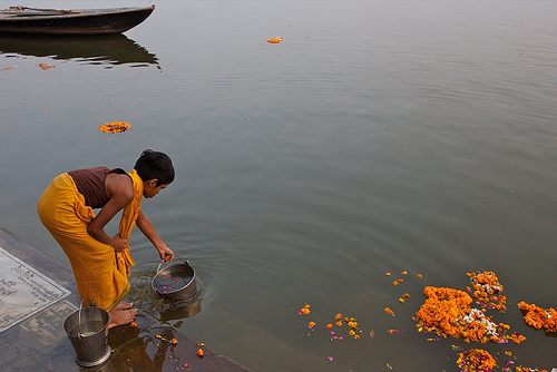
Starting Wednesday and for the next six weeks, legions of devout Hindus will celebrate the "Ardh Kumbh Mela" or Half Grand Pitcher festival in the city of Allahabad, at the confluence of the Ganges and Yamuna rivers.

Allahabad is one of four spots where Garuda, the winged steed of the Lord Vishnu, is said to have rested during her battle with demons over a pitcher of divine nectar.

But chronically high levels of pollution have turned this river goddess into a potential killer. For the nearly 75 million pilgrims - setting the record for the world's largest gathering of people - who will travel here to bathe their sins away, sip the river water, or cremate their dead, the "holy dip" is believed to usher them more quickly into a state of nirvana.

Leading Indian environmentalists claim the $100 million Ganga Action Plan (GAP), launched 20 years ago to treat sewage dumped in the river, has failed. They blame poor planning, corruption, lack of technical knowledge, and a gross miscalculation of the volume of waste from Varanasi, a teeming city of around 1.2 million people, which they say has left pollution levels worse than ever.

Kicked off in 1986 by former Prime Minister Rajiv Gandhi, the GAP aimed to divert and treat the waste and bring the quality of water up to bathing standards. However, in Varanasi, where raw sewage spews into the river from 30 sources, levels of fecal coliform bacteria are up to 3,000 times the accepted Indian standard and 1.5 million times the safe level for drinking.
The river's destitute state is no mystery to the hordes of fervent devotees.

This year, hundreds of holy men have threatened to commit mass suicide during the festival to protest what they say is a lack of government action, the Daily Telegraph reported last week.

Read more

Audio slide show: Atomic Museum


Henry Fountain discusses the Titan Missile Museum in Sahuarita, Ariz., USA, an educational facility housed in an old missile silo.

Interesting to say the least.

Listen to the audio slide show: Atomic Museum

Friday, January 05, 2007

GPS view of New York skyline


The Top of the Rock is linking up with the bottom of a satellite to show Big Apple tourists another side of the city.

Visitors to the year-old Top of the Rock Observation Deck at New York's Rockefeller Center can now rent a cellphone-size, interactive tour-guide device, CityShow, that incorporates a Global Positioning System, reports USA Today.

CityShow consists of a computer, a GPS receiver and a pair of headphones, and it provides listeners with historical facts, photos, music and descriptions of various features on the tour.

When users ascend to the upper deck on the 70th floor for a 360-degree view of the skyline, the GPS detects which direction they are facing and points out various landmarks and buildings.

Will we see such high-tech gadgets in Mumbai soon?


Tuesday, January 02, 2007

Video: Proof that travel broadens the mind

An adorable preschool ethnic Indian kid remembers all the state capitals of USA.

Proof that travel broadens the mind.


Travel quote: Lao Tzu

"A good traveler has no fixed plans
and is not intent on arriving."

~ Lao Tzu

Taking on 'Europe's toughest hike'


The guidebook described the first day of the walk as "a shock to the system ... the ascent is unremitting; uphill all the way. You climb higher than anywhere in Britain, then climb even further". I read this on the bus as it veered dangerously around the north coast of Corsica to Calenzana, the start of "Europe's toughest hike", the GR20.

At the local campsite, as we silently pitched our tent in torchlight, I began to fully appreciated the challenges I would be facing over the next five days: more than 38 hours on foot, 16,435ft in ascent, 12,685ft in descent. "Preparation," the book warned, "is key". Our only preparation had been a "smash and grab" trip to a camping store, and between two of us we'd probably done a combined total of 20 hours exercise in the past year.

The guidebook was right. The GR20 is a very tough walk. Indeed, it is more than a walk, it's peppered with scrambling, climbing and, during the steep descents, shuffling down on my bottom. In parts you rely on your hands almost as much as your feet to scale, ape like, up the tricky ascents. The path is not a reassuringly well-trodden gravel route, but leads, seemingly at random, over giant granite slabs, maquis-matted woods and steep rocky climbs, depicted only by red and white flags daubed on rocks and trees. The landscape seems to change step by step and there is a fairytale quality in it's transition from forest to rock face.

Read more.

Monday, January 01, 2007

Foreign embassies issue travel warning on Bangkok

Several foreign governments have issued travel warnings on Bangkok for their citizens on Monday after multiple bomb attacks in Bangkok on the New Year's eve, which killed three and injured about 38 persons.

They included Australia, Britain, Canada, New Zealand and the United States. They issued travel advisories to their citizens in Bangkok to stay at home and avoid moving about the city.

They also warned that more attacks were possible in coming days.

New Zealand's foreign ministry issued a travel warning about Bangkok on Monday, saying there was some risk to security and recommending tourists to exercise "a high degree of caution" in Bangkok following the New Year's Eve bombings.

The ministry advised New Zealanders in Bangkok to avoid unnecessary travel within the city and said terrorist attacks may also occur elsewhere in Thailand, including in tourist areas.

Read more.

Happy New Year


Happy New Year.
May 2007 be your best year yet.

From all of us at TravelPort India.

Saturday, December 30, 2006

How to entertain yourself for free in London

London has a reputation of being an expensive city. Certainly transport and accomodation can be pricey but there is still plenty to entertain visitor and resident alike that won't break the bank.

Steps

  • Consider a walk down the South Bank. The north side of the Thames is where the power (Parliament) and money (the City) historically lived. The South Bank was, until comparatively recently, outside the purview of the London police. It has always been more anarchic than the north side as a result. A glance at historical maps shows that this was the site of the original Globe (and its modern reconstruction), bear pits, taverns, flesh pots and so on. It's a lot more salubrious these days but retains its bohemian heritage as it is home to the Tate Modern Gallery, the Royal Festival Hall, The national Film Theatre, County Hall (home of the now defuct GLC), the Globe and the nice but crowded Borough Market (my local!). A wander along the South Bank is definitely worth it.

  • Get culture. All the major museums and art galleries are free to enter, but they do solicit donations in order to try to keep them that way. Give what you can. This helps to make London one of the most culturally democratic cities in the world. One highlight is Holbein's "The Ambassadors" in the National Gallery, but with four major galleries and countless smaller ones there is something for everyone. The Big Three museums are in Kensington: the Natural History Museum, the Victoria and Albert and the Science Museum. Each one of these could easily take up to a day to explore, depending on your level of interest, so glance at the websites first if opossible and plan your visit if time is tight. The British Museum is near Euston, on the north side of the city centre. It is large and proverbially quite eclectic (in Artificial Intellignce circles the British Museum search is one which tries each and every path and has no information to help it navigate - you may feel this way after a while in there.)

  • Walk, don't tube. This is a note for visitors to our fair city: In Zone one in particular, many of the tube stations are quite close together. The tube map is schematic - that is, the distance between stations is not to scale. This makes for a wonderful piece of draughtsmanship but doesn't tell you how far you're travelling. You can get an "Overground/Underground" map in some vending machines on some tube platforms (mainly the ones at mainline stations). These are great for showing alternate walking routes. Or better still, invest in the Londoner's choice: the A-Z. The more dog eared and scribbled on the better! If your feet really are giving out, try the buses. With an Oyster card, fares are very cheap indeed and you get to see the sights. Taking one of the routes that crosses any of the bridges is great fun - especially on the top deck of a double decker. Try the 188, 168 or 68 from Russell Square (by the British Museum) to Waterloo (handy for the South Bank), for a great view from Waterloo Bridge. It's not free, but it's 80p with an Oyster at the time of writing!

  • Take Your Sandwiches to the Parks. You can walk from Westminster to Knightsbrige almost entirely on grass, thanks to the swathe of parks that cover a large section of central London. These are a restful haven from the rest of the busy, often commercial, city. There are plenty of things to see and do - see the Royal Parks website for maps and guides. Speaker's corner in Hyde Park is particularly entertaining, and will banish forever your view of London as a reserved city. In the north of the city, near Euston, you can find Regent's park - small but very nice, with a well laid out English garden.

  • Listen and Learn. London is home to a number of institutions: the Royal Society (of science), the Royal Society of Art, the Dana Centre. Quite often these hold free talks by distinguished and/or entertaining speakers. See websites of the respective institutions for details.

  • Go to a BBC filming/recording. Many BBC radio and TV programs need a live audience. Search the BBC website for audience tickets and fill in the order form. Tickets are free and cover everything from Top of the Pops to Gardners' Question Time.

  • Catch some free music. The Royal Festival Hall often has music in their foyer - see their website for details. Many churches also have chamber music or choral events that may not be free but that are accessible for a charitable donation.

  • Find a nearby book shop. Go to the music section and hook up with the cute girl on the help desk. Begin by asking questions about non-existing bands.

    Tips

  • Look in Time Out for free events.

  • Wander around a lot. Especially on the South Bank. You'll often see outdoor exhibitions, events and festivals, especially in the summer.

  • Eat at staff subsidized canteens (Selfridges, Harrods, many newspaper offices). I have not done this since 9/11 therefore security likely will be tougher now but there's nothing wrong in trying. Try to blend in with the surroundings, think of yourself as having a right to be there and don't blab too loudly (especially if you have an American accent). Play the dumb, glassy eyed tourist if caught "um, the guy at garden furniture told me to go here..." Chances are you get a decent meal at a cheap price.

    Warnings
  • Buying food and drink in cafes around the tourist areas can be very pricey. Cheap eats are a real find and knowledge of good, cheep cafes and restaurants is often jealously guarded. Time Out do a cheap eats guide that can be of some assistance but if in doubt, and the weather permits, picnics are by far the cheapest option.
  • You may just fall in love with that cute girl.

    Wikihow. Creative Commons license.

Friday, December 29, 2006

The Anti Jet Lag Diet

Hundreds of thousands of travelers have requested copies of the Anti-Jet-Lag Diet over the years. Among them are President Ronald Reagan (whose personal physician consulted with Dr. Ehret), the U.S. Army and Navy, the U.S. Secret Service, the Central Intelligence Agency, the Mormon Tabernacle Choir, the Chicago Symphony Orchestra, the World Bank, the Federal Reserve System, and the Canadian National Swim Team, and dozens of corporations, scout groups, church groups and other travelers.

The diet grew out of studies of circadian rhythms -- natural body cycles controlled by molecular "clocks" found in every cell of the body -- by scientists at the University of Chicago's Argonne National Laboratory

Here's the The Anti Jet-Lag-Diet:

To avoid jet lag, the Anti-Jet-Lag Diet uses some of the same time cues that cause it. These time cues include meal times, sunset and sunrise, and daily cycles of rest and activity. Normally, they work together to help keep the body on schedule and healthy.

The Anti-Jet-Lag Diet is more than a diet. It helps avoid jet lag with a coordinated plan that combines a number of time-giving cues -- including alternate days of moderate feasting and fasting -- to help speed your adjustment to a new schedule. Still, we call it a 'diet' because meals are central. What you eat sends your body signals about waking up and going to sleep. And because meals tend to occur at reasonably consistent times during the day, their regularity helps to reinforce the regularity of other time-setting activities.

The Anti-Jet-Lag Diet can help avoid jet lag with a planned rescheduling of time-giving cues. It starts a few days ahead of your departure date to prepare your time-zone adjustment by carefully planning the amounts and types of food eaten at meal times. On the day of you arrive at your destination, your body's clock is reset by assuming the same meal and activity schedule as people in the new time zone.

An example traveling east: A traveler planning a Sunday flight from New York to Paris faces a nine-hour flight across six time zones. The traveler plans to arrive Monday at 10 a.m. Paris time, and wants to advance his or her body clock so it is not still set for 4 a.m. New York time upon arrival.

To avoid jet lag, the traveler begins the Anti-Jet-Lag Diet on Thursday, three days before the flight. Meals are eaten at their regular New York times. Thursday is a feast day, to be followed by fasting on Friday, feasting on Saturday and fasting on Sunday. The day of the flight is always a fast day.

Feast days: On feast days, you eat three full meals. Take second helpings. Breakfast and lunch should be high in protein. Steak and eggs make a good breakfast, followed later by meat and, perhaps, beans for lunch. Protein helps the body produce chemicals it normally produces when it's time to wake up and get going. High-protein meals do not need to be exclusively protein, but they should emphasize it.

Supper is high in carbohydrates. They help the body produce chemicals that it normally produces when its time to bring on sleep. Spaghetti or another pasta is good, but no meatballs -- they contain too much protein. High-carbohydrate meals need not be exclusively carbohydrate, but they should emphasize it.

Fast days: On fast days, eat three small meals. They should be low in carbohydrates and calories to help deplete the liver's store of carbohydrates. Acceptable meals on fast days would contain 700 calories or less and might consist of skimpy salads, thin soups and half-slices of bread.

Whether feasting or fasting, the traveler drinks coffee, or any other drink containing caffeine, only between 3 p.m. and 5 p.m. This is the one time of day when caffeine seems to have no effect on the body's rhythms.

Flight day: Sunday evening -- flight day -- you board the plane about 7 p.m. and begin the first phase of speeding up your body's internal clock to Paris time. Drink two or three cups of coffee between 9 and 10 p.m., turn off the overhead light and goes to sleep.

Destination breakfast time: About 1:30 a.m. New York time, you take the final steps that reset your body's clock to Paris time: You begin a third feast day, but this one is based on Paris time. It may be 1:30 a.m. in New York, but in Paris it's 7:30 a.m. -- your normal breakfast time. You wake up -- the coffee you drank before going to sleep helps you do this -- and eat a high-protein breakfast without coffee; it might be last night's supper, which you saved for breakfast. Most airlines will gladly agree to this request. The large, high-protein meal helps your body wake up and synchronize itself with the Parisians, who are eating breakfast at about the same time.

Stay active: Having finished breakfast, you stay active to keep your body working on Paris time. The other passengers may be asleep, but you are walking the aisles, talking to the flight attendants or working at your seat.

Monday afternoon in Paris, eat a high-protein lunch. Steak is a good choice. That evening, eat a high-carbohydrate supper -- crepes, for example, but with no high-protein meat filling -- and go to bed early.

Tuesday morning, you wake up with little or no jet lag.

The return trip, traveling west: On the return trip, the procedure is reversed, with one change. Going from east to west, you want to turn the body clock back six hours so that upon arrival at, say, 10 p.m. New York time, your body clock is not still set at 4 a.m. Paris time. The same feast-fast-feast-fast procedure is followed as before.

For the first four days, your meals and activities are on Paris time. Your fourth day -- a fast day -- is the day you leave Paris. In the morning, you drink two or three cups of caffeinated coffee. You break the fast with a high-protein "breakfast" at the same time New Yorkers are eating breakfast.

At that point, you begin a third feast day, but on a New York time schedule. Do not nap on the plane after you break the fast. Stay active and alert. In New York, go to bed about an hour earlier than usual. Wake up the next morning with little or no jet lag.


Medical caution: Remember to be safe. If you are under a doctor's care, you should consult your physician before using the Anti-Jet-Lag Diet -- not because using the Anti-Jet-Lag Diet will harm you, but because varying your doctor's instructions might.

For a small fee you can get your personalized anti-jet-lag diet here.
All copyrights acknowledged.